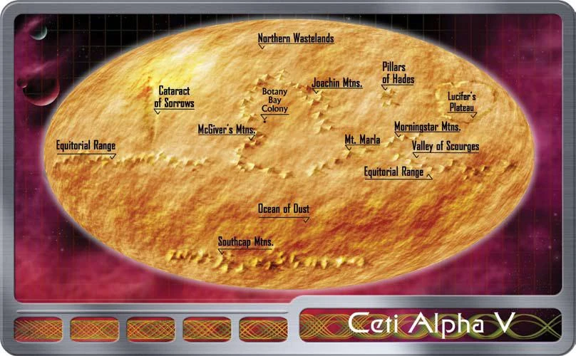
Planetary map of Ceti Alpha V showing the location of the Equatorial Range.
The Equatorial Range was a geographical feature, a mountain range situated around the equator of the planet Ceti Alpha V.
History and specifics
The mountains were formed in part due to the close proximity of Ceti Alpha VI and its gravitational pull on the planet. Prior to the year 2268 the highest peak in the range was about ten kilometers. After the explosion of Ceti Alpha VI, and the development of intense storms on Ceti Alpha V, the Equatorial Range was significantly eroded and worn down. So much so, that by 2285, the highest peak was only 6,400 meters. (Decipher RPG module: Worlds)
Appendices
Connections
| planet Ceti Alpha V |
|---|
| Azar Gorge • Botany Bay colony • Cataract of Sorrows • Equatorial Range • Joachin Mountains • Lucifer's Plateau • McGiver's Mountains • Morningstar Mountains • Mount Marla • Northern Wastelands • Ocean of Dust • Pillars of Hades • Southcap Mountains • Valley of Scourges |
Background
In the single source mentioning this feature, it was notably misspelled as the "Equitorial" Range.